That’s right, you read correctly. Sorry LOTR fans, but it’s not just Tolkien’s world that injects pure magic into the country. New Zealand lends even more proof that the world of rocks is more intriguing and awe-inspiring than you may think.
New Zealand is known, thanks largely in part to the Lord of the Rings movie franchise, for being one of the most beautiful countries in the world. It’s a place my dad raved about for years and to this day continues to, even after he visited the islands 7 years ago (this article is for you, by the way). The south and north islands are known for their geological features, unmistakable throughout all three Lord of the Rings films.
If you’re like me, you wonder what it is that contributed to such prominent geological features; what natural processes created some of the most popular images in the world.
Look no further, my fearless readers. It turns out, because of the geographical position of the islands, with resect to the Pacific Mobile Belt (better known as the Ring of Fire), it is one of the most volcanically active regions in the world.
The islands, including north, south, and Stewart Islands, also include the continental shelf surrounding it below sea level (and which was once above sea level). New Zealand sits astride two tectonic plates – the Pacific and the Australian plates. The north island experiences the most volcanic activity because it rests on a subduction zone. If you recall in previous posts, when a denser, older plate is pushed beneath a younger, less dense plate, you get subduction and volcanic activity. In this case, the Pacific plate, being older, denser, but also thinner, is pushed underneath the lighter Australian plate, contributing to the five areas of volcanic activity on the island. The Taupo Volcanic Zone (also an area of the most recent volcanic activity on the island) includes the three active cones: Ruapehu, Tonganiro/Ngauruho, and White Island. This area also includes the two most productive calderas in the world: Okataina and Taupo.
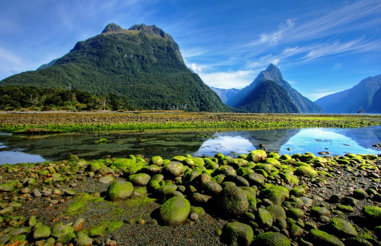
The north island is also known for its iconic mountain ranges, of which the Northwest Nelson and Fiordland are comprised of some of the oldest rocks in the country, and the result of mountain building and resistance to erosion. The southern Alps (read: Pangea for those of you still doubting plate tectonics) run along the island forming a sort of mountainous spine.
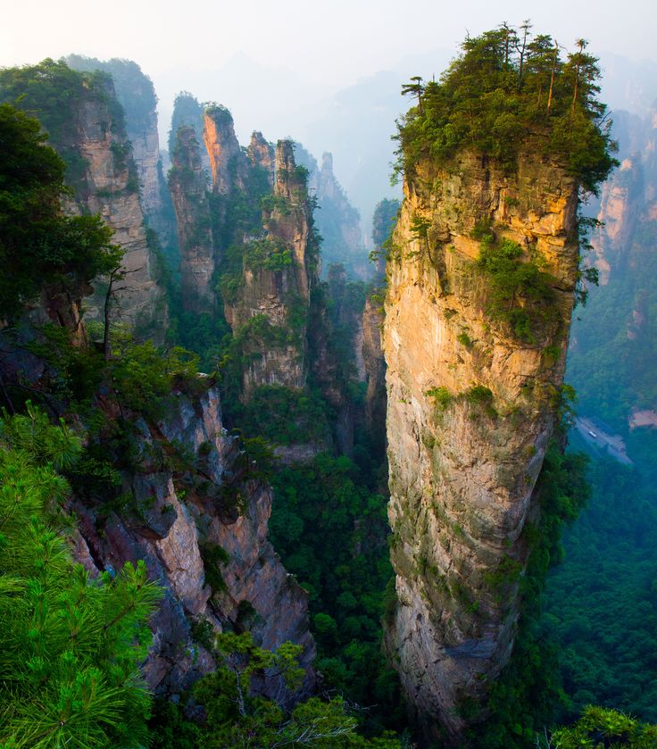
Some of the more interesting geological features are formed from bodies of limestone prevalent on the island. Because limestone easily dissolves in highly-acidic water (such as rainwater), large beds of limestone often give way to extensive cave systems, sink holes, and my personal favorite: karsts. If you don’t know what a karst is, it’s a tall pillar, like a large jagged finger sticking straight up from the ground. They are also common in China, and chances are you’ve seen a picture of one without knowing it. Though limestone is a rather common rock, when married with water and weathering, it creates some of the most beautiful geological features I’ve ever seen.
While the north island is most famously known for its volcanism, the south island is quieter, but not without its own geological activity. The Alpine fault occurs where the Pacific and Australian plates rub together horizontally, resulting in frequent seismic events (earthquakes).
Don’t let any of that deter you. California is known for its earthquakes and volcanoes, and people can’t get here fast enough. The world is a beautiful and spectacular place.
If rocks and fault lines don’t inspire you to adventure through the New Zealand country, go for the fact that you can visit the Shire and walk where hobbits walked.